With its high Alpine peaks and turquoise seaside, there's no shortage of beautiful walks in Provence-Alpes-Côte-d'Azur. Here we present our favorites, suitable for both family outings and a more demanding sporting challenge.
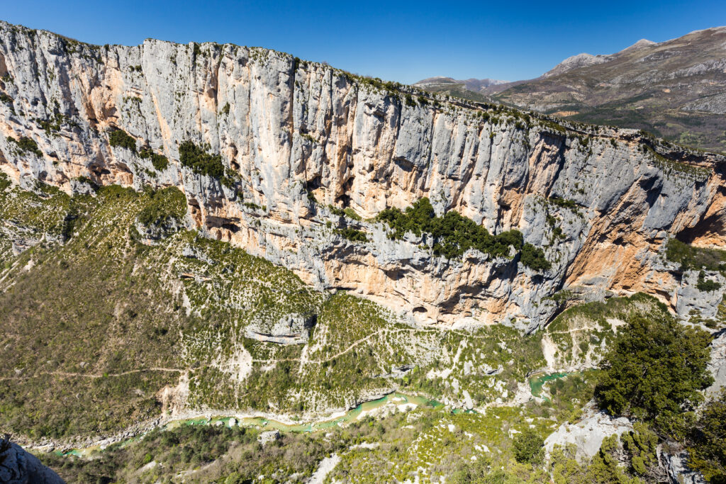
1. The lower gorges of the Verdon

- Distance: 9.8 km
- Difference in altitude: 290 m
- Walkingtime: 2 h 45
- Itinerary
There's no better way to admire the Gorges du Verdon, one of the region's most beautiful landscapes, than to embark on this beautiful hike in Provence-Alpes-Côte-d'Azur before rewarding yourself with a refreshing dip in the water. This is a medium-level loop, but not recommended for young children, as there are passages with ladders, albeit not too vertiginous. For this reason, you'll need to be well equipped, with good shoes. It's well worth the effort, though, as this unforgettable hike takes you through Europe's largest canyon!
2. The GR® 52: Grande traversée du Mercantour, one of the most beautiful hikes in Provence-Alpes-Côte-d'Azur
- Distance: 100 km
- Difference in altitude: 6,730 m
- Duration: 4 to 8 days
- Itinerary
The GR® 52 is one of France's legendary hikes, taking several days to complete. It is, however, a particularly difficult GR, as it has a considerable vertical drop. You'll need to be well-trained to rise to the challenge. The route owes its relief to the fact that it crosses the Mercantour massif, from Saint-Dalmas de Valdeblore, a magnificent village in the Alpes-Maritimes, to Menton on the Côte-d'Azur. Along this beautiful hike in Provence-Alpes-Côte-d'Azur, you'll be walking at an altitude of 2,700 km at times. As you approach the coast, however, the end of the route is less steep, so you can give your calves a rest.
3. Calanque d'En-Vau
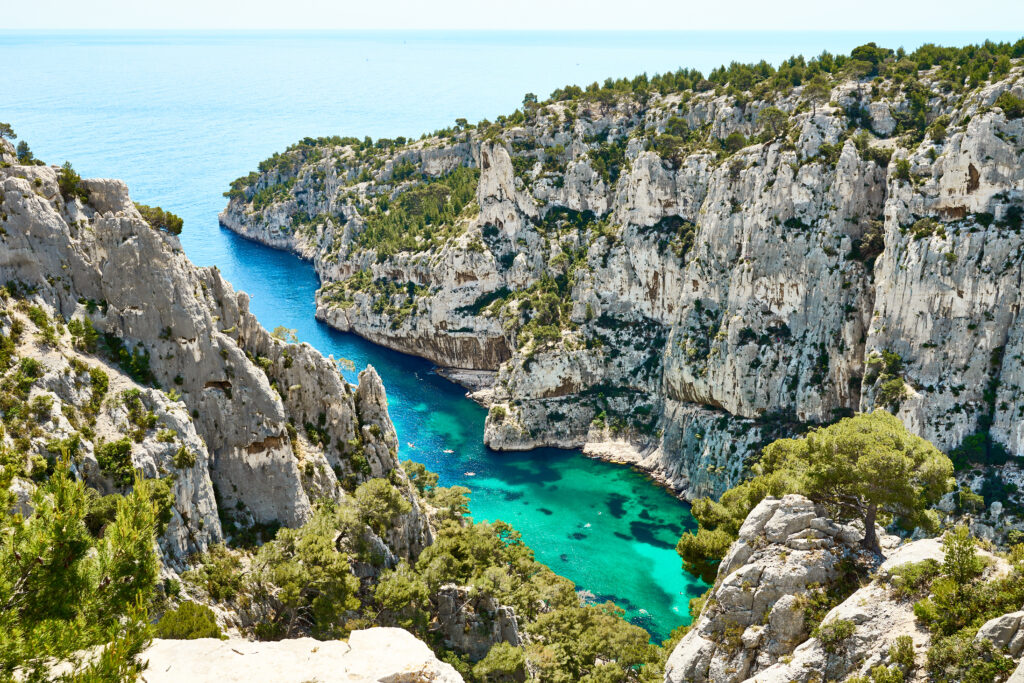
- Distance: 6.6 km
- Difference in altitude: 331 m
- Walkingtime : 2 h
- Itinerary
The Calanque d'En-Vau is perhaps the most beautiful of the Calanques National Park in the Bouches-du-Rhône region. But this natural beauty also means that it is very popular with visitors. Nevertheless, it deserves its place among the most beautiful hikes in Provence-Alpes-Côte-d'Azur, as the panorama is absolutely sublime. The medium-level path can be steep in places, so it's advisable to bring good shoes, and why not hiking poles, for Nordic walking. Finally, the calanque is located at the end of Marseille's 9th arrondissement, so you can take advantage of the opportunity to visit the city.
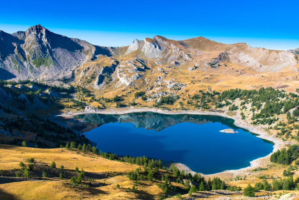
4. Lac Sainte-Anne and Lac Miroir

- Distance: 13 km
- Difference in altitude: 800 m
- Time: 4 hrs
- Itinerary
This itinerary in the heart of the Queyras Regional Nature Park in the Hautes-Alpes is quite demanding, due to its steep gradient: no less than 800 m over a distance of just 6 km, before returning downhill on the loop trail. At the end of your efforts, you'll be able to admire two magnificent mountain lakes, Lac Miroir and Lac Sainte-Anne, reminiscent of the Dolomites. The latter, perched at an altitude of 2,414 m, is the largest lake in the Queyras. Because of the altitude, be careful not to be caught out by snow or ice in winter, but also in mid-season.
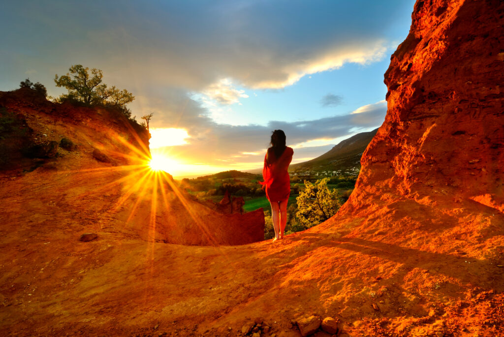
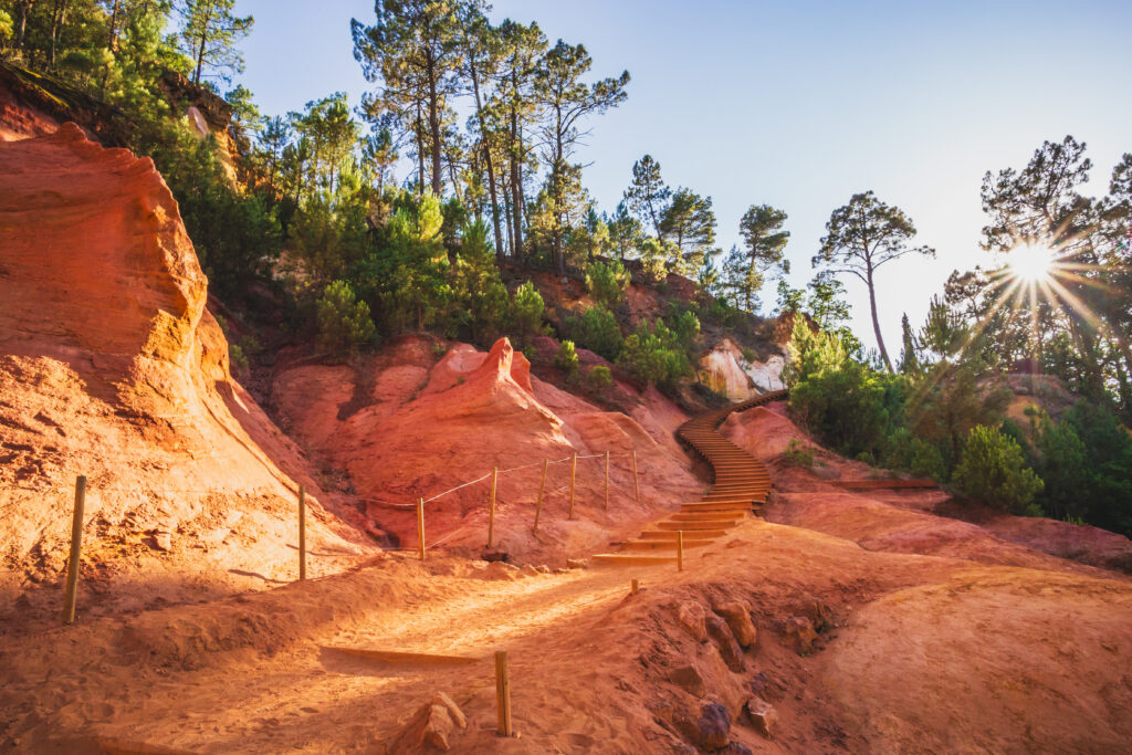
5. The Provençal Colorado: one of the most beautiful hikes in Provence-Alpes-Côte-d'Azur
- Distance: 3.5 km
- Difference in altitude: 112 m
- Duration: 1 h
- Itinerary
This medium-level route, which is short but includes a slight incline, lets you explore the Provençal Colorado, one of the most famous spots in the PACA region. In the heart of the Luberon Regional Nature Park, this red earth landscape looks like something out of a Western. While this loop trail gives you a good overview of the site, you can also choose to continue your walk by taking one of the many footpaths. Please note that in summer, you'll need to reserve your parking space in advance.
6. Sources de l'Huveaune

In the Bouches-du-Rhône region, the turquoise Huveaune river meanders through the trees, creating caves and basins in the rock. You can walk back to its source under the trees of this green destination, making it a great Provence-Alpes-Côte-d'Azur hike in warm weather. Be careful, however, not to take this hike in dry weather, as the river could run dry.
7. Mont Ventoux from Mont Serein

- Distance: 9.2 km
- Difference in altitude: 535 m
- Time : 3 h 30
- Itinerary
This beautiful hike in Provence-Alpes-Côte-d'Azur sets out to conquer Mont Ventoux, the most famous peak in the Vaucluse region. The peak, at 1,910 m, is reached after a fairly steep ascent. It's a rather difficult hike, but accessible to all, provided you train a little beforehand, as it doesn't include any technical passages. Mont Ventoux is an ideal destination for hiking, as in addition to being criss-crossed by several trails of varying levels, it offers superb panoramic views of the region.
8. The Blanc-Martel trail
- Distance: 13 km
- Elevation gain: 1,046 m
- Duration: 6 h 30
- Itinerary
The Blanc-Martel trail is one of the most famous routes in the Gorges du Verdon, but also one of the most difficult. In fact, it's quite long and, above all, particularly steep. The trail takes its name from two men who, in 1905, were the first to explore the Verdon Gorge via this path. It starts in Rougon, one of the most beautiful villages in the PACA region, perched in the rock. You'll then walk in the shade of the rocks, even passing through a few tunnels that require a headlamp. You'll finish at the Chalet de la Maline. The route can be taken in either direction.
9. Sugiton calanque: one of the most beautiful walks in Provence-Alpes-Côte-d'Azur

- Distance: 6.3 km
- Difference in altitude: 270 m
- Duration: 2 h
- Itinerary
Still in the Parc National des Calanques, on the outskirts of Marseille, this time head for another site: the Calanque de Sugiton. Like its cousin En-Vau, it's popular and often quite crowded, but offers views of the Côte Bleue that are well worth the detour. Along the way, you can even enjoy a panoramic view of the Calanque de Morgiou. The path is rocky, steep and slippery, so a good pair of walking shoes is essential. Take sun cream too, as the path is not in the shade.
10. The Grand Morgon

- Distance: 10.9 km
- Difference in altitude: 785 m
- Time: 5 hrs
- Itinerary
This hike takes place in the relief of the Hautes-Alpes, and is therefore of a difficult level. Fortunately, where there's relief, there's also sublime panoramas! Indeed, all along this loop trail, and particularly on reaching the summit of Grand Morgon, culminating at 2,324 m, you'll enjoy exceptional views. Equip yourself with binoculars, as you may even be lucky enough to cross paths with a few marmots. Despite the altitude difference, this is not a dangerous hike, as it is well-marked and does not include any overly technical passages, although good footwear is essential.
Discover our Top 13 hikes in the Alps !
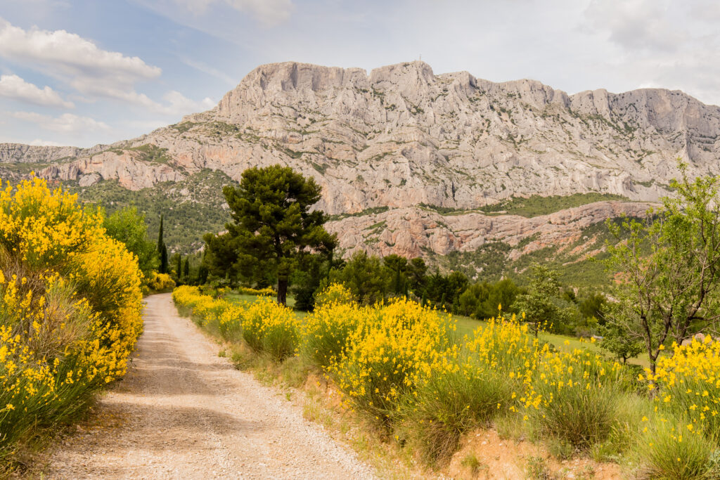
11. Bimont and Zola dams
- Distance: 9.8 km
- Height difference: 257 m
- Time: 2 h 45
- Itinerary
This Pays d'Aix hike is particularly popular, as it offers sublime views of Provence's most famous mountain: Sainte-Victoire. You don't need to climb it, however, so this is a medium-level hike. In fact, you'll be staying at its foot, walking over the Bimont and Zola dams, and the Mediterranean landscapes that stretch between them.


