8 DAY LEMOSHO ROUTE KILIMANJARO CLIMB
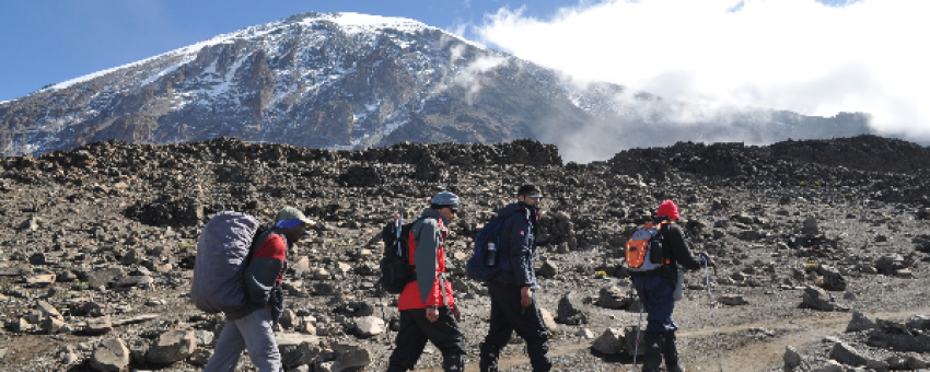
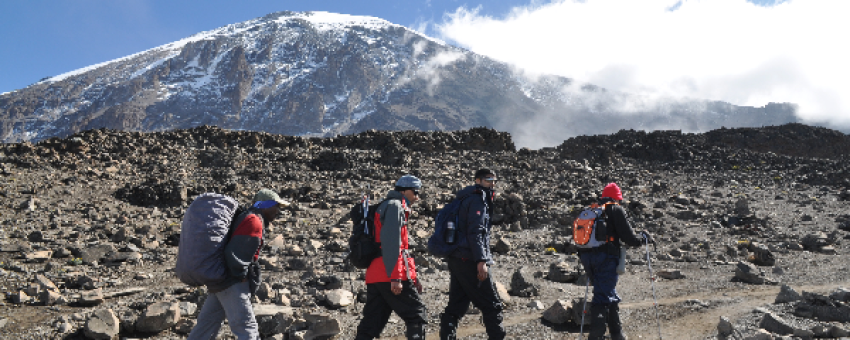
Tanzania is a great destination for those looking for an active holiday adventure and offers you the chance to experience waterfalls, nature, wildlife, spectacular scenery, wildlife from national parks, towns and villages which share a backdrop of towering mountains, vast savannah, caldera's, craters or the Rift valley. Africa's highest peak at 5895m or 19,341ft; Uhuru peak - Mount Kilimanjaro, is one of the most popular options although there are many possibilities and off the beaten track locations as well.
Climb Kilimanjaro
A journey to Mount Kilimanjaro is an exploration, not merely a climb. For some the appeal is simple: it is the highest mountain on earth whose summit is accessible to any committed walker without advanced skills, technical experience or special equipment. A well-prepared city-dweller may be able to reach 'the roof of Africa'
Highlights of the trip
During your stay you can enjoy the following highlights: Faune and flora, Adventure / Sports & Leisure, Off the beaten track, Nature travel, Travelling alone and travelling in a group.
Best months to go
The best time(s) to go is/are : Janvier, Février, Mars, Juillet, Août, Septembre, Octobre.
How to get there?
You can get there by , Car.
SHAH TOURS
From 2595€ à 3475€ / person
Travel suitable for :
Detail of the stay : 8 DAY LEMOSHO ROUTE KILIMANJARO CLIMB - 8 days
Moshi to Londrossi gate to Big tree (Mti Mkubwa) camp

Today has no planned activities and is only an arrival day for you to reach your base lodge in time for a pre-climb briefing (time to be confirmed) with your mountain guide. A shared shuttle airport transfer is included from Kilimanjaro International Airport (time and flight to be confirmed) to Moshi.
Approx driving distance: 1-2
hoursApprox trekking time:
NoneApprox trekking distance:
NoneStart Altitude:
UnknownEnd Altitude:
UnknownHighest Altitude reached:
UnknownAltitude +gain / -loss:
UnknownMeals included:
None
Big Tree (Mti Mkubwa) camp to Shira One camp

You will be transferred by road from Moshi (09:00am) to Londorossi gate. After registration you continue the 4x4 track till the trail head where you begin your trek through the rain forest zone with your guide. The forest is thick and diverse with flora / fauna, and you may experience rain this afternoon which is common in this zone making the path slightly slippery. A short and winding path takes you steadily to the first camp.
Approx driving distance: 2-3
hoursApprox trekking time: 3-4
hoursApprox trekking distance:
7km or 4.
5miStart Altitude:
2100m or
6890ftEnd Altitude: 2780m or
9120ftHighest Altitude reached: 2780m or
9120ftAltitude +gain / -loss: +680m or
+2230ftMeals included:
Breakfast, picnic lunch, dinner
Shira One camp to Shira Cathedral Peak to Shira Two camp

This morning you quickly leave the forest zone on a steep path as the dense vegetation slowly eases into the Heather and moorland zone. The remainder of the day takes you on a steady hike across the Shira ridge where views of the Shira peak (the third of Kilimanjaro’s volcanic cones) gives you the spectacular jagged scenery of this eroded peak.
Approx driving distance:
NoneApprox trekking time: 4-5
hoursApprox trekking distance: 7km or 4.
5miStart Altitude: 2780m or
9120ftEnd Altitude: 3505m or
11500ftHighest Altitude reached: 3505m or
11500fTAltitude +gain / -loss: +725m or
+2380ftMeals included:
Breakfast, picnic lunch or lunch, dinner
Shira Two camp to Lava Tower to Barranco camp

Todays hike takes you gradually across the Shira Plateau within the heather and moorland and an optional extra hike to the Shira Cathedral peak (3880m) before gradually taking you to Shira two camp. Shira is the third of Kilimanjaro’s volcanic cones and has been shaped by lava and volcanic activity to create a stunning jagged peak and offering a unique western view of Kibo, the highest of the peaks and your final destination on the tour.
Approx driving distance:
NoneApprox trekking time: 3-5
hoursApprox trekking distance: 6km or
4miStart Altitude: 3505m or
11500ftEnd Altitude: 3845m or
12615ftHighest Altitude reached: 3872m or
12705ftAltitude +gain / -loss: +340m or +1115ft / -27m or
-90ftMeals included:
Breakfast, picnic lunch or lunch, dinner
Barranco camp to Karanga camp

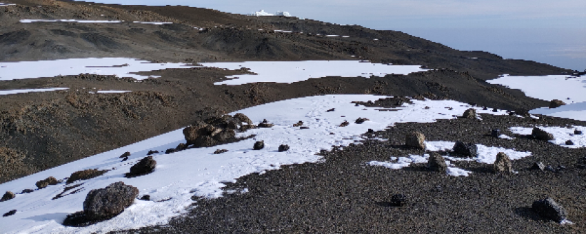
Your hike today takes you towards to Kibo cone steadily climbing up and over the edges of the alpine desert to your first high altitude at the lava tower (4630m or 15190ft). Today helps you to acclimatize and also is a great indicator to see how your body can handle the higher altitude. From the Lava Tower you begin your steep descent anti clockwise around Kibo and into the Barranco Valley passing the large flowering mountain cacti (Kilimanjaro Senecios) unique to Kilimanjaro. The day ends around the same elevation as you started on the edge of the heather and moorland.
Approx driving distance:
NoneApprox trekking time: 6-8
hoursApprox trekking distance: 10km or
6miStart Altitude: 3845m or
12615ftEnd Altitude: 3960m or
12990ftHighest Altitude reached: 4630m or
15190ftAltitude +gain / -loss: +785m or +2575ft / -670m or
-2200ftMeals included:
Breakfast, picnic lunch or lunch, dinner
Karanga camp to Barafu Camp

This morning you will leave the camp and ascend the Barranco wall. This is an impressive non-technical scramble and gives a feeling of mountain climbing (without any previous experience or advanced equipment required) and is rewarded with a superb view from the top back into the camp and the Heim glacier on the peak. The remainder of the hike will be through the alpine desert slowly winding around the mountain till the Karanga valley which you descend into and again up till your camp. Karangu valley is the last water point.
Approx driving distance:
NoneApprox trekking time: 3-5
hoursApprox trekking distance: 6km or
4miStart Altitude: 3960m or
12990ftEnd Altitude: 4040m or
13255ftHighest Altitude reached: 4250m or
13945ftAltitude +gain / -loss: +290m or +955ft / -210m or
-690ftMeals included:
Breakfast, picnic lunch or lunch, dinner
Barafu Camp to Stella point to Uhuru peak to Mweka camp

Today you climb almost casually through the empty landscape of the alpine desert where you keep a slow pace even though the path is not extremely steep. Kibo cone starts to near and you may finally glimpse the Mawenzi peak (Kilimanjaro’s second peak) in the east. The short distance means you have plenty of time at your summit camp to rest and prepare for the summit attempt tonight.
Approx driving distance: None
Approx trekking time 3-4 hours
Approx trekking distance: 4km or 2.5mi
Start Altitude 4040m or 13255ft
End Altitude 4640m or 15225ft
Highest Altitude reached 4640m or 15225ft
Altitude +gain / -loss +600m or +1970ft
Meals included: Breakfast, picnic lunch or lunch, dinner
Mweka Camp to Mweka Gate

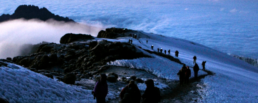
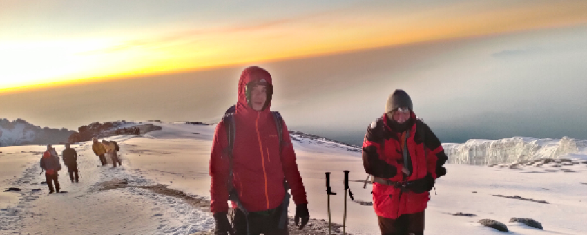
In the early morning (around 00:00am) you begin your final ascent to the summit of Uhuru peak through the arctic zone. The trek is a steep hike over loose volcanic scree through the dark and cold night and takes a slow pace in a zig-zag pattern towards Stella point (5685m or 18650ft) which is your first stop on the Kibo crater rim. From here a short (but difficult) hike remains to take you to Uhuru Peak (5895m or 19341ft), the highest point in Africa. You usually don’t spend that long at the peak due to the extreme altitude and will descend back down to the base camp for your breakfast / brunch. After your gear is packed up you continue the descent through the alpine desert, heather and moorland and eventually stopping at Mweka camp in the rain forest zone for a well-deserved rest.
Approx driving distance:
NoneApprox trekking time: 14-18
hoursApprox trekking distance: 19km or
12miStart Altitude: 4640m or
15225ftEnd Altitude: 3700m or
12220ftHighest Altitude reached: 5895m or 19431ft (Peak!)
Altitude +gain / -loss: +1255m or +4206ft / -2195m or
-7211ftMeals included:
Breakfast, picnic lunch or lunch, dinner
