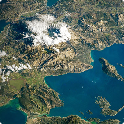
"An island surrounded by land
This is how the illustrious writer Augusto Roa Bastos described his country. Paraguay is indeed located 611 km from the Atlantic Ocean and 819 km from the Pacific. The rivers Paraguay, Apá and Paraná, as well as the Amambay and Mbaracayú mountain ranges form a natural border with Brazil, from north to south-east. The Paraná, Paraguay and Pilcomayo rivers separate it from Argentina. The border with Bolivia is located in the arid region of Chaco Boréal.
A country cut in two
The Paraguay River divides the country into two large regions with distinct geological, geographical and demographic characteristics. Eastern Paraguay (39% of the territory) has a varied relief, consisting of hills, cordilleras, plateaus and wet or dry plains. Land suitable for agriculture. Temperatures and rainfall are less extreme than in the western part of the country. To the west of Río Paraguay is the vast Chaco, Paraguay's "Wild West", a wild land of great beauty but with a particularly hostile environment. The Chaco represents 61% of the national territory, and comprises three distinct areas: the humid Chaco (or Lower Chaco), bordering the Paraguayan River, the semi-arid Upper Chaco, further west towards Bolivia, and the Paraguayan Pantanal to the north.
A land of water
The country's three main rivers are the Río Paraguay, which divides the country in two (2,800 km, of which 1,023 km are through Paraguay), the Río Paraná (4,700 km, 830 km through Paraguay) and the Río Pilcomayo (2,000 km, 835 km through Paraguay). These waterways are of vital economic importance for the country, between hydroelectric power, crop irrigation, fishing, and river transport (Paraguay is thethird largest river power in the world, behind the United States and China). Rivers and lagoons are never far away, and the country's two largest lakes, Ypoá and Ypacaraí, are close to Asunción. While the famous Iguazú Falls are not in Paraguayan territory, but only a few kilometres away, Paraguay has impressive waterfalls in the same geographical area, such as Saltos del Monday and Saltos del Ñacunday, or Salto Cristal, in the department of Paraguari. Finally, Paraguay shared with Brazil a marvel that has disappeared forever: the Saltos del Guairá, or Seven Falls Waterfall. It was the largest waterfall in the world. Its record flow, nearly 50 million litres per second, far exceeded that of the Iguazú Falls. It disappeared in 1982, flooded by the gradual rise of the waters of the Itaipú dam.
The Guarani aquifer
The eastern part of the country rests on a gigantic hydrographic basin, the Guaraní aquifer, considered to be one of the largest freshwater reserves in the world. An aquifer is a layer of rock that is sufficiently porous and permeable to contain a groundwater table. The Guaraní aquifer extends under the original territories of the Guaraní peoples, covering approximately 1.2 million km². The countries concerned are Brazil (70 per cent of the aquifer), Argentina (19 per cent), Paraguay (6 per cent) and Uruguay (5 per cent). This aquatic reserve would represent 50,000 billion tons of pure and drinkable water (two centuries of world consumption!). The water is between 5 m and 1,800 m deep. The aquifer is made up of several geological formations, with "recharge" zones where surface water can infiltrate into the ground to reach the groundwater table. The main ones are located in Paraguay, in the departments of Caazapá, Alto Paraná and Itapúa. These are regions where agricultural activity is intense, which implies a risk of groundwater pollution by fertilizers and pesticides. The aquifer has so far been exploited by means of wells and boreholes, without any real consultation between the countries concerned. A transboundary project "for the protection and sustainable development of the Guaraní aquifer system" was launched a few years ago. Financed by the World Bank, it has been the subject of fierce controversy because of the presence of foreign North American companies suspected of taking over water resources and setting up operations in the "triple frontier". In a world where water is an increasingly precious resource, the Guaraní aquifer has become a major geopolitical issue.
Relief
Paraguay consists mainly of vast plains, both in the eastern region and in the Chaco. There are no high mountains, but several cordilleras systems, the highest of which are in the eastern part of the country. Amambay, Mbaracayú, Caaguazu and Ibytyruzu are the country's most marked reliefs. The Mbaracayú Cordillera, with an average altitude of 200 m above sea level, forms a natural border of more than 120 km between Paraguay and Brazil. It is very old, more than 40 million years old, which corresponds to the Mesozoic era. The Amambay Cordillera, which also forms a natural border with Brazil, has an average altitude of 400 m over about 200 km. Its highest peak is the Ponta Porâ (700 m). The Caaguazú Cordillera, a continuation of the Amambay and Mbaracayú Cordilleras, is divided into two other cordilleras called Cordillera and Ybytyruzú. Thelatter hosts the highest point of the country, the Cerro Tres Kandú(842 m), in the vicinity of Villarrica. Towards Asunción, there are small elevations appreciated by hikers: Cordillera de los Altos, Serranía de Ybytymí, Paraguarí, Ypacaraí, Areguá, Ñemby... On the other side of Río Paraguay, in the western part of the country, some mountains rise, such as Cerro Olimpo, Galván and Siete Cabezas. Further into the Chaco, the Cerro León is a unique geological formation 40 km in diameter made up of a succession of 46 hills, the highest point of which reaches 604 m in height. It lies isolated in the heart of the Defensores del Chaco National Park. To get there, it is essential to use the services of an agency specializing in adventure, such as DTP Travel Group, Gran Chaco Turismo, or Paraguay Safari.


