Reliefs and geographical areas
The territory is marked by the great rivers and plains of southern and central Russia. However, the Caucasus contrasts with this landscape, with several peaks exceeding 4,000 m
The North and the High North. Bordered by St. Petersburg in the west, the Urals Mountains in the east, and extending north to the Arctic Ocean well beyond the Arctic Circle, the Russian North in the broadest sense is a cold, wet, inhospitable land, but often bewitchingly beautiful. The Northwest is dotted with lakes of widely varying sizes. Lake Ladoga with its 18,000 square kilometres is the largest in Europe. Some of these lakes are covered with thousands of islands, the smallest of which are no larger than 1 m² and sometimes house architectural treasures, such as the Kiji Island or the Solovetski Islands. If the North is a relatively flat region, some mountainous massifs emerge all the same: the Khibiny Mountains in particular, culminating at more than 2,000 m and bordering the tundra in the Kola peninsula, are of an astonishing beauty. Their boreal position means that they are covered with snow almost all year round
Central and Western Russia. Central Russia is marked by the predominance of forests and rivers. The region is crossed by the Volga, the largest river in Europe. This majestic river is one of the symbols to which Russians are most attached. The "Mother Volga" has inspired more than one artist, played a major role in the history of the country and even gave its name to the top-of-the-range Soviet car model. The 3,350 km long Volga River feeds a fertile and prosperous basin and is a vital communication route for the Russian economy. The south of central Russia is more arid with the beginning of the great steppe that stretches from the Ukraine to Kazakhstan. This aridity ends where the first rivers flow from the foothills of the Caucasus
The Caucasus and the Black Sea coast. The Black Sea coastline is not very large: 400 km on the Black Sea and 350 km on the Sea of Azov. Nevertheless, the lush vegetation and the almost tropical climate ensure a very large number of visitors. Especially in its southern part overhung by the Caucasus. Stretching at the junction of Europe and Asia, between the Black Sea and the Caspian Sea over 1,200 km, the Caucasus covers two continents and four countries (Russia, Georgia, Azerbaijan and Armenia). Its highest point, Mount Elbrus, at 5,642 m, is the highest peak in Europe. There are three main parts in the Caucasus Massif: the North Caucasus is the most imposing part with numerous glaciers and snow-capped peaks and marks the border between Russia on one side, Georgia in the south-west and Azerbaijan in the south-east. The "Lesser Caucasus" mountain range in the south runs through southern Georgia and Azerbaijan, Armenia, and the extreme north-east of Turkey. Its average altitude is 2,000 m.
The Russian Far East extends 4,500 km in length from the coast of the Pacific Ocean, from the Chukchi peninsula to the borders of Korea and Japan, and covers 3.62 million km². The territory is mainly mountainous. The chain ridges of the Kamchatka volcanic peninsula culminate at high altitudes (Klyushchevskaya Sopka, 4,750 m). The Aleutian Islands, the Kuril Islands and Sakhalin Island also belong to this region. The climate is extremely harsh. The region remains under ice for 200 to 270 days a year. In the north of the plain, the winter is long and harsh, the summer humid and cool. In the southern regions, the winter is less cold, the summer is hot and dry. Average January temperatures range from -25 °C in the north to -18 °C in the south; in July, they vary between +2 °C and +22 °C
The Urals extends along the sides of the mountain range of the same name from the north (Kara Sea) to the south (Kazakhstan). It is also the watershed. The mountain range is actually relatively low and easily crossed, it has never really represented a border for anything. It was under Peter the Great, the reformist czar who wanted to anchor Russia in Europe, that it was decided that the massif would symbolize a "natural" boundary between European and modern Russia and the rest of the Empire
Western Siberia extends from the Urals to the Yenisei; its surface area is 3 million km². This gigantic, water-saturated Northwest is rich in oil and gas deposits. Swamps cover one third of the territory. It includes the Tyumen, Omsk, Novosibirsk, Tomsk, and Kemerovo regions, the Altai territory, the Gorno-Altai and Yamalo-Nenets autonomous regions
Eastern Siberia extends from the Yenisei to the watershed of the Pacific Ocean mountain ranges and covers 4.1 million square kilometres
The seas
There are many seas bordering Russia. To the southeast, the Caspian Sea is actually the largest lake in the world: its basin is endorheic, meaning that its waters do not flow into any sea or river. The question of the legal status of the Caspian Sea is a major international political issue! Since the fall of the USSR, the riparian states (Iran and the former Soviet republics of Russia, Azerbaijan, Kazakhstan and Turkmenistan) did not manage (at least on the surface) to agree on the legal status of the body of water until 2018. For between "sea" and "lake", the rules relating to the exploitation of resources are different. The Sea of Azov, with a surface area of only 38,000 km², flows into the Black Sea. The latter is also "landlocked" with only one exit to the Mediterranean through the Bosporus Strait. To the northwest, the Baltic Sea offers an opening to the Baltic countries and Scandinavia. To the north, the Barents Sea and the White Sea, both part of the icy Arctic Ocean, are often frozen in winter. For Siberia and the Far East, the four Siberian North Seas (Kara, Laptev, East Siberian Sea and Chukchi Sea) form part of the icy Arctic Ocean and are frozen for part of the year. The Pacific coast is composed of partially enclosed seas (Bering Sea by the Aleutian Islands, Sea of Okhotsk by Kamchatka and Sea of Japan by the islands of the Japanese archipelago). Thus, its many sea fronts have in no way been a factor in opening up Russia, which is definitely not a thalassocracy. This explains the recurrent desire to obtain access to the sea and maritime routes and the many "pushes towards the warm seas" that have been recorded throughout the history of the Tsarist Empire, the Soviet Union and the Russian Federation. However, this opening up will perhaps happen in about ten years' time with global warming and the opening up of the northern route for Europe-Asia trade, via the icy Arctic Ocean, which has become sufficiently cold to allow the passage of tankers and other container ships.
Rivers and streams
Russia is a country of rivers and streams and since its origins, these have played a decisive role in its history. In the European part, the most important are the Volga, which flows into the Caspian Sea (3,350 km), the Don, which flows into the Sea of Azov (1,950 km) and the Oka, which flows into the Volga at Nizhny Novgorod (1,500 km). The Volga ends its long journey in a steppe area around Astrakhan, forming a gigantic delta. In Siberia, the major rivers flowing northwards are the Ob, the Yenisei (4,000 km) and the Lena (4,400 km). The Amur (4,400 km) flows into the Pacific, opposite the island of Sakhalin. Lake rather than sea, Baikal is the largest freshwater reserve in the world.
Urban geography
Russian cities have gigantic proportions, especially in the European part, which is much more industrialized and urbanized than Siberia and the Far East. In an ultimately very American style, everything is bigger than in Europe: the blocks, buildings, streets, etc.. It takes courage to cross a major thoroughfare in Moscow, and to pass through countless perekhods, those underground passages designed to facilitate both pedestrian and car traffic. And since there is no lack of space, cities can generally expand at will: for example, Volgograd, rebuilt after the battle, is 859 km² for about one million inhabitants (by comparison, Paris is 105 km² for two million inhabitants). It is often said that cities in Russia follow one another and look alike. The statement is not entirely true, as there are some peculiarities related to history and physical constraints, but it is understandable. Indeed, most of the Russian territory was conquered as a result of military victories over nomadic or tribal peoples who lived, at best, in large villages. Thus it was the Tsarist (and later Soviet) power that created most of today's urban centres
City centre. In most of Russia's old cities, the city centre is recognizable by its classical or neo-classical architecture. Some older elements remain (in the Kremlins, churches, palaces), but are rare, as most of the pre-18th century wooden buildings were destroyed by the successive fires that ravaged many Russian cities. In some medium-sized cities (Astrakhan, Irkutsk, Kazan), former popular suburbs reserved for minorities (Tatars, Armenians, etc.) consisting of small wooden isbas dating from the 19th century have been preserved. Initially located on the outskirts of the cities, they are now in the city centre.
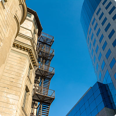
First circle. For from the 20th century onwards, we see history unfolding in successive layers on the map of cities and forming concentric circles. Around the historic centres, where they have survived, we inevitably find the large avenues typical of Stalinist town planning, which were opened up as early as the 1930s. These are lined with imposing monolithic blocks, but with refined details borrowed from neo-classicism: columns, balconies, bas-reliefs. This is the "Stalinist imperial style", which is crude and functional, but conservative. It will radically change the morphology of cities: a whole block can be made of only one building (and thus correspond to a single number, which has the gift of exhausting foreigners looking for an address). Gone, then, are the narrow Art Nouveau buildings that flourished in Saint Petersburg at the beginning of the century
Second circle. Continuing the walk outside the city, we come across districts that are radically different from the grandiose Stalinist achievements, even though they are not very far from them in time. These are the mikroraion ("micro-neighbourhoods"), built en masse by Khrushchev in the late 1950s in response to the massive rural exodus. The buildings are low and grouped together in bars, they are called khrushchevki, and most of the time, piatietajny (from piat "five", because they often have five floors). The khrushchevki landscapes that follow one another sometimes make one think furiously of certain French housing estates, except that the khrushchevki were not built to accommodate the working classes. Far from it: we were even very happy to move in, whereas the large bourgeois apartments in the city centres had been divided into kommunalka (community apartments) where one family lived per room, with shared toilets and kitchen. The khrushchevki were larger, more comfortable and better insulated. And the Mikroraions were designed to function as small, closed-circuit utopias: they still had schools, administrative offices, local shops and good public transport. But the khrushchevki, built in record time, are rapidly deteriorating and some are already falling into ruin. In Moscow, there is even talk of destroying them in order to rehouse the inhabitants in more modern towers
Third circle. On the outskirts of the cities is the urban testimony of Russia's recent history. These are modern building complexes, which are mainly built on high ground and claim to be of European standing. But nothing is ready yet and these future upmarket districts are sometimes still surrounded by wasteland or very poorly served by public transport.
The Russia of the fields
The Russian villages, especially in the north of the country, have for many remained authentic and rural, escaping the recent concreting. This is not only a positive phenomenon: the fall of the USSR has completely halted the development of the countryside by centralizing economic growth in the cities and intensifying the rural exodus. In many villages, sovkhozes (state farms) closed down abruptly, leaving the inhabitants with a choice between unemployment and emigration. Half-abandoned khrushchevki blocks can be found in all rural areas of Russia. But in some unspoiled corners there are still old isbas, flower gardens and sometimes a small lake or river flowing in the middle. No wonder so many Russian families own a dacha, these small country houses located a few hours away from their place of residence. Those Russians who can, spend every weekend there, fishing or grilling shashlyks (traditional meat skewers from the Caucasus). If you have the opportunity, a little trip to the countryside is the best way to discover the enchanting aspect of the country, and to share a nice moment of conviviality with your Russian friends that you will inevitably make on the way.


