In a few figures.
In a few figures.
Area: 338,452 km2 , 86% of which is forest. The rest in water and cultivated land.
40 national parks in total over 10,000 km2.
187,888 lakes!
1,324 m, the highest point in the country for Mount Halti.
The "Land of a Thousand Lakes"
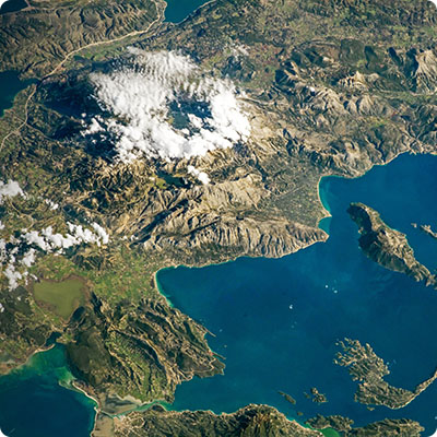
Finland's generally very low relief was formed during the Quaternary Ice Age, of which the morainal deposits and ridges are clear evidence. Finland is also known as the Land of a Thousand Lakes, with thousands of shallow lakes, usually between 5 and 20 metres deep. An unforgivable underestimate: there are at least 187,888 of them! They cover a quarter of the central part of the country. Rivers and canals also connect the largest lakes. These lake regions with their "tormented" configuration are characterised by multiple lakes and numerous islands separated by narrow channels. As such, Grand Saimaa forms the largest and most complex of these lake systems. At the same time, the country's poor drainage favours swampy soils covered by a thick mantle of peat bogs. The Finnish name for Finland, Suomi, is said to mean "swamp". Forests occupy dry soils and cover almost 70% of the land. The few large rivers, such as the Torneäly and Kemijoki, are mainly located in the north. Southern Finland is gently undulating with gradients rarely exceeding 100 metres. Most of the large cities inspired by Nordic architecture and organisation are concentrated in the south. Well planned, they are integrated into the landscape and the surrounding nature.
Europe's last remaining virgin spaces
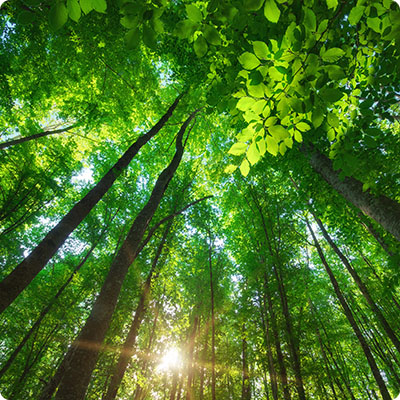
Lapland, which occupies almost a third of Finland, has only two inhabitants per square kilometre. Low population density is both one of the country's strengths and weaknesses. If France had the same population density, its population would not reach two million! Eastern Finland, for its part, has the last large unspoilt areas in Europe. The region of large forests and high wooded hills begins north of the lakes where rivers and foaming rapids flow. The forest, which occupies almost 70% of Finnish soil, is the gallery forest type with huge barrels reaching up to the sky. Pines (45%), firs (37%) and birches (18%) make up the great arctic and subarctic forest. In places, the tall silver birches with white trunks are reminiscent of the vast boreal forests of nearby Russia. In Lapland, the tundra makes its mark in an unforgettable landscape.
National Parks
The national parks (40 in total over 10,000 km2) are very well equipped and offer a large number of itineraries to be completed on foot or on skis. To embark on the adventure requires a minimum of information, so as not to turn the pleasure into a nightmare, even if the hikes are generally very well indicated and marked. Nature is not only grandiose, it can also be hostile. So ask about huts (some with sauna), fire and camping sites, fishing and canoeing areas to organize your trip as well as possible
Southern Finland
Nuuksio National Park (45 km2). About 50 km from Helsinki (bus 85 terminus from Espoo), this park has five routes for exploring Finnish nature with lakes, rocky cliffs, forests, small wooden bridges..
National parks Liesjärvi (21 km2) and Torronsuo (30 km2). Information centre in Letku. These two national parks, a few kilometres apart, are radically different
The first one with its hiking trails along the lakes or hidden in the cool woods is extremely green. The second, on the other hand, with its tracks built on swamps can remind you of autumn in the African savannah
Lakes region
Helvetinjärvi National Park (49.5 km2). Information centre in Länsi-Aure. It is full of treasures for sporty hikes. The most impressive site is certainly Helvetinkoulu, a deep break through which one reaches the lake from the top of the cliff. There are numerous camping facilities, including one on the beach
Linnansaari National Park (37 km2). Information centre at Rantasalmi. National park of a rather special kind with its group of islands on the huge lake Saimaa. During the summer it is possible to take the boat from Rantasalmi, but as this landscape is ideal for canoeists, you can also rent your own boats in Oravi. There is a camping area on the largest of the islands (possibility to rent bungalows and access to the sauna). In Oravi, also in winter, an ice road is open for skating from Oravi to Porosalmi via Linnansaari (22 km), with accommodation on both sides of the lake
Arctic Circle
Oulanka National Park (272 km2). Information centre in Kuusamo. Close to Kuusamo and Salla, this park, crossed by the Oulankajoki (river with rapids, suitable for rafting and spear fishing) is of striking wild beauty
The 75 km long Karhunkierros (Karhunkierros) trail, Finland's most famous long-distance hiking trail, leads through wild landscapes, over suspension bridges over rushing waters, along sandbanks and along the banks of the river... Free shelters along the way. In summer, with the crowds, bring your own camping equipment. In winter, there is the possibility of snowshoeing from Oulanka (the paths are prepared, but very little traffic). Treks depart from the information centre (ask them directly).
Lapland
Lemmenjoki National Park (2,855 km2). Information from the Northern Lapland Nature Centre in Inari. It is crossed by the river of the same name which flows into Lake Inari. The cliffs of Viipus are the most impressive attraction of the park. The cliffs drop steeply from a height of 450 m into the river. From the end of June to mid-August, boats travel along the river
U.K.K. National Park (2,538 km2). Koilliskaria information centre in Tankavaara. This huge playground for experienced hikers stretches from Raututunturit-Saariselkä to the Russian border. It is a protected area and unique for the diversity of its flora and fauna. A stop in the centre of Koilliskaria Mountain is recommended to prepare for the adventure. Along the trails, huts and campsites allow for stops
Kevo Nature Park (712 km2). In north-eastern Lapland, about 30 km south of Utsjoki on the way to Inari. It is worth the detour to cover part of its 40 km long "grand canyon", which is the biggest natural attraction in northern Lapland. It should be visited from the north, near the narrow Kevojoki river, to enjoy the most beautiful panorama of Kevo.


