The Venus Archipelago
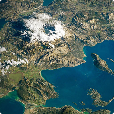
So far and so near, the Tuscan archipelago, still intact, is the largest marine park in Europe with its 61,474 hectares of sea and 17,694 hectares of land, and was created in 1996. This string of islands offers wild nature, preserved sanctuaries, ancient fortresses and wonderful beaches.
Legend has it that the seven Tuscan islands were formed as a gift from the gods when Venus was born from the waters and the pearl tiara that adorned her forehead broke. The pearls scattered on the surface of the sea and became the islands of the Tuscan archipelago: Elba, Gorgona, Capraia, Pianosa, Montecristo, Giglio and Giannutri.
From a historical-geographical point of view, the island of Elba represents a small piece of Pangaea, the supercontinent which, 250 million years ago, encompassed the whole of the emerged lands. The Alps and the Apennines were formed there, of which the island is the westernmost offshoot.With its 223 square kilometres, Elba is the largest island in the Tuscan archipelago and the third largest of the Italian islands, after Sicily and Sardinia. It is also a favourite with tourists! 29 kilometres long and 18.5 kilometres wide, the island stretches its 147 kilometres of indented coastline and offers varied landscapes: scrub, pine and chestnut forests, terraced crops, pebble and fine sand creeks... Mount Capanne, the highest point of the island with its 1,019 metres, is the result of an underground magma rise 7 million years ago, and is composed of granodiorite (a type of granitic rock).
From an administrative point of view, the island of Elba belongs to the province of Livorno in Tuscany. Covering an area of 22,987 square kilometres, Tuscany is one of Italy's twenty regions. The island comprises eight municipalities: Portoferraio (capital and main port), Campo nell'Elba, Capoliveri, Marciana, Marciana Marina, Porto Azzurro, Rio Marina and Rio nell'Elba.
One island, three regions
The island of Elba is geographically, historically, geologically and culturally divided into three distinct regions. This approach can be found on most island maps, but also in the spirit of every Elbois. It is also the geographical division that you will find throughout this guide, with the intention of sticking as close as possible to the reality on the spot.
The western region, first of all, constitutes the western slope of the island of Elba, isolated by the great natural barrier formed by Mount Capanne. The coastline of this part of the island is so curved that one seems to stand on a large balcony open to the sea.
As for the central region of the island of Elba, its relief is much flatter than the neighbouring slopes. Pines and scrublands cover the gentle hills, which were once cultivated and grazed. The Medicean fortifications of Portoferraio, the historic capital and main gateway to the island, stand on the north coast. The central region also boasts some of the most beautiful Elbo beaches.
Finally, the eastern region, which forms the eastern slope of the island, reveals a formidable mineralogical character. Between the black sandy beaches and the purplish-red rocks, infiltrated with iron oxide, which extend into the sea, a veritable explosion of colours awaits you! The numerous iron ores and hydroxides (magnetite, hematite, limonite, pyrite, ilvaite...), of exceptionally varied hues and oxidation, can be seen almost everywhere. This region constitutes the ancestral mining heart of Elba Island, and offers a striking palette of contrasts between beaches, mountains, scrubland and ancient iron quarries.Geology
Initiated 230 million years ago, the geological formation of the seven islands of Tuscany is very diverse: Capraia, for example, is volcanic, Pianosa consists of limestone, while Giglio and Montecristo are essentially granitic. This geological variety influences the shape and landscape of each island.
On the island of Elba, the geological variety is remarkable. Among the seven islands of the archipelago, Elba is the most diverse geomorphologically. There are three distinct zones: the western region with the granite ridges of Mount Capanne; the central region formed by plains and little relief; and the eastern zone, finally, rich in metamorphic rocks containing iron. The iron ores present in the east of the island have, in fact, been exploited since the Etruscan era. The promontory of Mount Calamita is home to the Ginevro mine (Galleria del Ginevro), the only underground mine on the island of Elba, dug more than fifty metres below sea level, and above all the largest iron reserve in Europe! It is said that this mine, closed in 1981, contained so much iron that even the sailors' compasses were lost in it! It was therefore necessary to make some clever calculations to overcome this disadvantage and to find your way around.
Elba has one of the world's largest mineral deposits. Unesco has classified Elba as a site of geological interest. A real open-air mineralogical museum! The Elbe deposits are also among the oldest iron deposits on the planet. The exploitation and production of iron on the island is particularly linked to the ancient mining town of Rio Marina, characterized by the reddish colour of iron oxide, also cited by Virgil in theAeneid.
Particularly abundant, iron ores have influenced the life and historical events of islanders for centuries. Among them are hematite, found mainly in the mines of Rio Marina, on the eastern slope of the island; and magnetite, the richest iron-rich mineral, black in colour, mainly mined on Mount Calamita, south of Capoliveri. Pyrite is the most visible of the ferrous minerals, as it is very bright and metallic yellow in colour due to the presence of sulphur.
Another iron ore is ilvaite, which owes its name to the fact that it was discovered on the island of Elba(Ilva in Latin) in 1803. It can be recognized by its elongated prismatic crystals, its matt black colour, and is found mainly on Mount Calamita. The Vecchia Officina Museum is located in the Calamita Mining Park. It is the ideal place to understand the importance of the iron industry since the Etruscans on the island, then called "the island of a thousand fires".


