CARBET FALLS
Three accessible waterfalls, including two in the heart of the National Park, among the most beautiful and impressive in the Lesser Antilles.
These three waterfalls, two of which are located in the heart of the National Park, are among the most beautiful and impressive in the Lesser Antilles. Along with the Soufrière volcano and its superb beaches, they make a major contribution to the archipelago's appeal. Every year, some 400,000 visitors come to admire the falls. The falls no doubt inspired the island's nickname: "Karukera", which means "island of beautiful waters" in Amerindian. As for the Grand Carbet river, its name seems to refer to the carbets, the large open huts built by the Amerindians. The sulphurous waters of the Grand-Carbet river brighten up after the three waterfalls and flow into the Atlantic Ocean 11 kilometers below. Legend has it that Christopher Columbus saw the first two falls from the shore when he landed in Guadeloupe in 1493.
The three falls are generally accessible after a 1 to 3-hour walk, starting from the lookout point at the park reception desk. Access to one of the falls is not always possible due to bad weather conditions.
The first waterfall. From the Carbet reception area, it takes around 1 hour 45 minutes of immersion in the rainforest to reach this first waterfall. Access is by two levels, as this is the highest waterfall at 115 metres above sea level. The walk takes at least 3 hours round trip, and the final access is quite difficult. Some passages are tricky, notably the crossing of the ravine Longueteau, which is dangerous in wet weather (beware of flash floods). We recommend arriving at the trailhead (before 1pm) to enjoy the walk, as in our latitudes, night falls by 6pm at the latest.
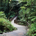
The second fall. This is the shortest and easiest trail. It can be reached in just 45 minutes. The access trail to the second waterfall has been completely renovated. It is now accessible to people with reduced mobility: wheelchair users have access to the reception area and can reach the first panorama. Footbridges and gates facilitate access to this humid forest, where weathering and seismic activity have reshaped the relief. For safety reasons, the 110-metre-high waterfall is visible from a suspension bridge. However, approaching it can be dangerous due to frequent rockfalls. That's why it can also be seen from an observation platform that can be reached in just 15 to 20 minutes' walk.
The third waterfall is the most famous. Its flow is still impressive given its moderate altitude (20 m). The water flows into a large circular basin. There are two different routes to this waterfall. From the north, it's a 2-hour walk from the reception area. To the south, from Capesterre-Belle-Eau, it's a 1-hour walk from the Routhiers and Petit-Marquisat districts. The trail also passes through a mahogany plantation dating from the 1950s-60s. Please note that access to the foot of the third waterfall (the last section) is still forbidden since a landslide in 2008.
For your own safety, make sure you always follow the recommendations of our reception staff, and make sure you're properly equipped, as well as informed about the state of any tracks that may be closed due to bad weather. In addition to essential equipment such as walking shoes, a hat or cap and rain gear, bring water, dried fruit and a charged telephone. Another important recommendation: always inform someone of your hiking plans (your landlord, for example).
Access to services is subject to a fee. Since June 2021, management of the site has been entrusted to the agents of Maranatha Tours. The substantial increase in access fees may come as a surprise to regular visitors, but it is justified in particular by the services on offer (parking, site maintenance, toilets, souvenir store, workshops, etc.). The sums collected help to maintain this natural heritage. A team is on hand to welcome visitors, provide information and raise environmental awareness, as waste is still being dumped on the site and plants are being harvested... The parking lot and toilets are accessible only to paying visitors.
The area around the Carbet Falls is dotted with several comparable stretches of water known as ponds. These mountains and ponds were created by multiple volcanic eruptions. Some are overgrown with vegetation, while others are not watertight and are gradually drained. The deepest ones are still home to ouassous (the local crayfish).
You can reach the Grand Etang from the parking area just beyond the hamlet of Habituée on Route Départementale 4. The walk around the Grand Etang takes around 1 hour. The wetland vegetation attracts a multitude of birds. The trail then takes you to a floating observation post where you can watch the local wildlife without disturbing it. From here, another trail is within easy reach. This is the Boucle des Etangs.
Did you know? This review was written by our professional authors.
Book the Best Activities with Get Your Guide
Members' reviews on CARBET FALLS
The ratings and reviews below reflect the subjective opinions of members and not the opinion of The Little Witty.


Si possibilité, faire les 3 chutes , avec de bonnes chaussures
Si manque de temps, faire juste la 1ère,
Le premier jour, nous avons visité la 3e chute par l'accès du Petit-Marquisat, aucun soucis d'accès en voiture jusqu'au parking aménagé par le Parc. Rando sportive, même pour de bons randonneurs. Mais la récompense est à l'arrivée !
Deuxième jour, visite des 2e et 1ère chutes, dont l'accès se fait par l'accueil du site (payant). 2e chute décevante, la passerelle n'a toujours pas été reconstruite(depuis 2004!). Mais la 1ère chute vaut le déplacement, c'est grandiose !
Accès 2,20 euros par personne en janvier 2016 !