Fogo Island in 3 days
Highlights of the trip
During your stay you can enjoy the following highlights: Faune and flora, Adventure / Sports & Leisure.
Best times to go
The best time(s) to go is/are : Printemps, Eté, Automne, Hiver.
Where to stay - Chã Das Caldeiras ?
The map of your stay "Fogo Island in 3 days"
Detail of the stay : Fogo Island in 3 days
How to get there - Chã Das Caldeiras
Arrival at the posada in São Felipe

I advise you as soon as you arrive at the airport to find a small "posada" in São Felipe; there are some charming ones described in this guide; leave most of your luggage there, to be able to hike lighter. Then, as always in Cape Verde, you will have to find an "aluguer" that will take you to Chã das Caldeiras (which could easily be translated as a boiler or cauldron, because it is so shaped). The entrance to this huge crater, dominated by the central peak, is simply impressive: everything is black, the walls of the crater, the ground covered with volcanic ash. You will find some posadas there, I would recommend Marisa and Mustafa's, you can always recommend yourself from your guide Le Petit Futé or from me. If you do not arrive too late in the day, you can climb the Pico Pequeño (1,920 m); for this reason, from the village go back a little further along the road, it is easily spotted on your left.
The ascent of Pico Fogo

Steps: Chã Das Caldeiras
Leave very early in the morning, to enjoy the wonderful sunrise, reflecting the gigantic shade of the volcano on the walls of the Caldeiras crater. For my part, I didn't leave later than 6am, to reach the summit before 10am. The start is just after the Adventist church, by a track on the right (altitude 1,695 m). On either side of the track, you will see amazing small individual craters containing a vine stock. This type of vine cultivation is found in many volcanic islands such as the Canary Islands for example.
After about fifteen minutes, at an altitude of 1,740 metres, you will see cairns on a rocky outcrop on your right; very quickly you will enter a lava song, follow due south, then looking at the summit of the peak, in the centre-east you will see quite clearly drawn rock outcrops; progress on them until 2,200 metres, to reach the summit rock. In fact "the Pico" is a cone with a very large crater. We first arrive at the edge of the crater, with a strong smell of sulphur; we can of course, with great caution, descend to the bottom of the crater, but I prefer to continue to rise. Climbing up the southwest side, or from the edge of the crater, slightly lower to your left, you will see a chimney of large, obvious blocks that will lead you to the ultimate scree. The views from the top are amazing. The descent is quite simple; as I told you, it can be very fun, but also strenuous, because you will descend these slopes composed almost exclusively of ashes, you can sink into it until mid-calf. Beware of falls and slips, it rasps! If you did not do so the day before, you can head west to reach Pico Pequeño, and then return to your base camp. Chã das Caldeiras is an incredible crater, the last eruption dates back to 1995, and man has come to reclaim this space every time; there are, as I told you earlier, vines, but also fig trees, apple trees, always with the same cultivation method, an individual crater dug into the ashes. If you have the chance to fall on a full moon night, the spectacle is even more striking.
The descent to Mosteiros
Steps: Mosteiros
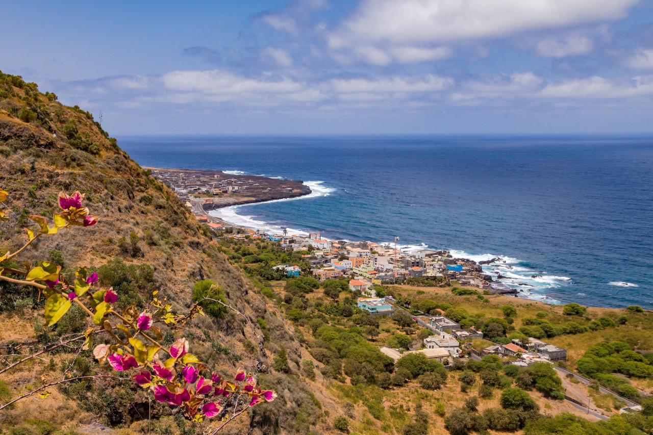
You will spend it going down to Mosteiros, through the Monte Velha park. During my first visit, I continued the ascent of the Pico with this very long descent to Mosteiros (count 4-5 hours), I arrived at sea level around 7pm, after a dozen hours of walking, and 1,300 meters of positive altitude gain and nearly 3,000 meters of negative altitude gain, so I had to finish at the front, exhausted. At the beginning you must leave Chã das Caldeiras, opposite to the place where you arrived the day before by car. At the exit of the crater, you will come across a fence and a small forest house; this is the entrance to Monte Velha Park (1,700 m); you will certainly have to pay an entrance fee to the ranger.
Just before the forest house, take an obvious path on your right (referenced 3 on your map). First you will cross a forest of eucalyptus, acacias and sisals; the further down you go, the faster you will find small farms, coffee trees, banana plantations, yam and manioc plantations.... If you have left early, you can continue your journey by taking one of the "aluguers" that will take you back to São Felipe, or stay in the afternoon and evening by the sea; there too there are still some guest houses.


