Between the Vosges mountains and the historic towns of Alsace, there's no shortage of beautiful hikes to be had. We've selected 11 of the most beautiful here, offering varying levels of difficulty, from the perfect family hike to a challenging walk to push your limits!
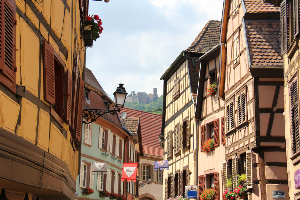
1. The three castles of Ribeauvillé
- Distance: 7.2 km
- Difference in altitude: 400 m
- Time: 3 hrs
- Itinerary
This is a must-do hike in Alsace if you want to discover both the region's landscapes and its heritage. You'll be immersed in Alsatian history, discovering three castles in turn, as you set off on foot from the medieval village of Ribeauvillé. These are Château de Girsberg, Château de Saint-Ulrich and Château du Haut-Ribeaupierre. This is a medium-level walk, as it climbs a little. But where there's a difference in altitude, there's also a panoramic view!
2. Crossing the Vosges Massif (GR®531)
- Distance: 375 km
- Difference in altitude: 12,734 m
- Duration: 18 to 25 days
- Itinerary
Crossing the Vosges Massif is one of France's most legendary Grandes Randonnées. It takes no less than twenty days to complete this demanding trek, which crosses the mountain range from north to south. A true adventure, this hike in Alsace allows you to discover its rich natural and historical heritage. Along the way, you can spend the night in a number of gîtes or bivouac.
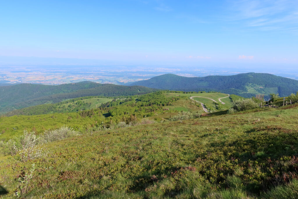
3. The Ballon d'Alsace tour
- Distance: 10 km
- Difference in altitude: 400 m
- Duration : 4 h
- Itinerary
This hike is not just Alsatian, but also Lorraine and Franche-Comté. The Ballon d'Alsace is the meeting point of the three regions! This mythical peak, 1,247 m high, is the highest point in the southern Vosges. Along the way, you'll enjoy spectacular panoramic views, not only of the Vosges massif, but also of the Jura and its particularly unspoilt landscapes.
4. Le sentier des Roches
- Distance: 18.3 km
- Difference in altitude: 1,000 m
- Duration : 7 hours
- Itinerary
Warning: this is a very demanding hike, reserved for the most seasoned walkers! It will take around 7 hours to complete, with a very steep ascent. This mountain trail will take you past the Hohneck, then the Petit Hohneck, two emblematic peaks. The Sentier des Roches is far from being a mass tourism destination, since its magnificent scenery makes it one of Alsace's most famous hikes, and one that can be quite busy.
5. Mount Saint-Odile
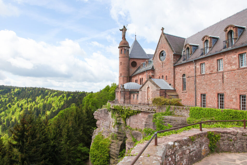
- Distance: 12 km
- Difference in altitude: 585 m
- Walkingtime : 5 h
- Itinerary
At 767 m, Mont Saint-Odile is far from being one of the highest peaks in the Vosges massif, but it is undoubtedly one of the most emblematic. A true symbol of Alsace, it offers not only a beautiful hike in Alsace, but also a fascinating and highly spiritual pilgrimage. The summit is topped by the Hohenbourg Abbey, a 7th-century convent. Here again, don't expect to find an alternative to mass tourism, as over a million people visit the summit every year.
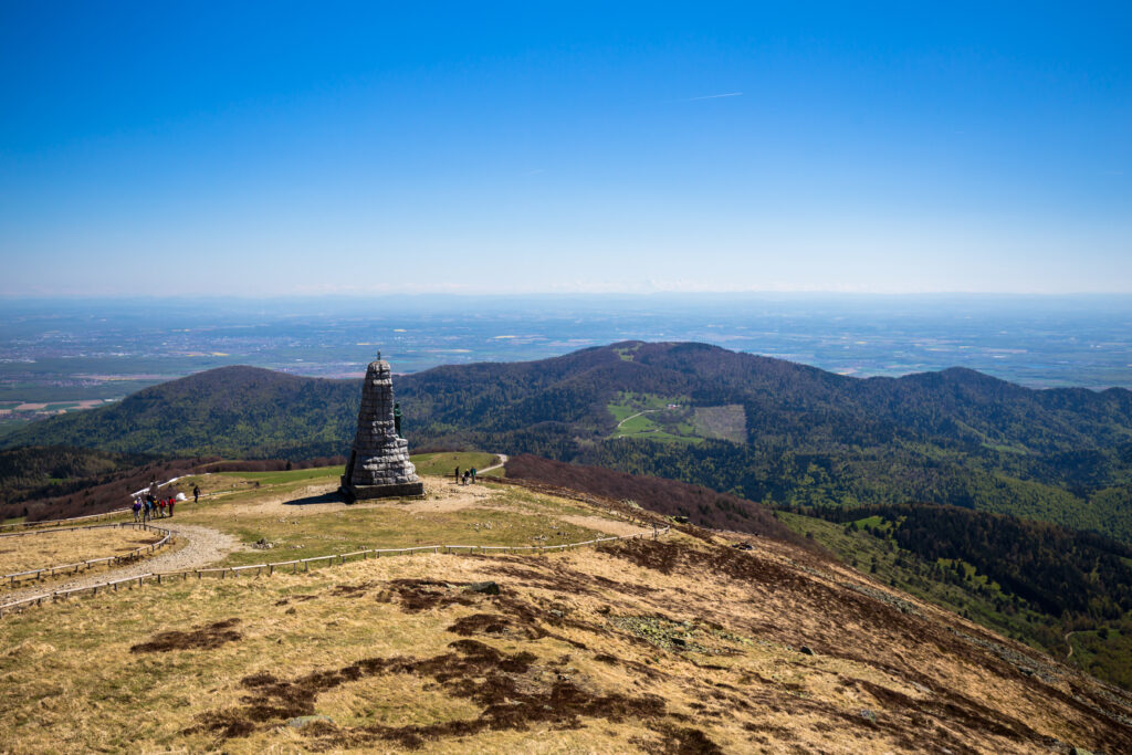
6. The Vosges ridge route
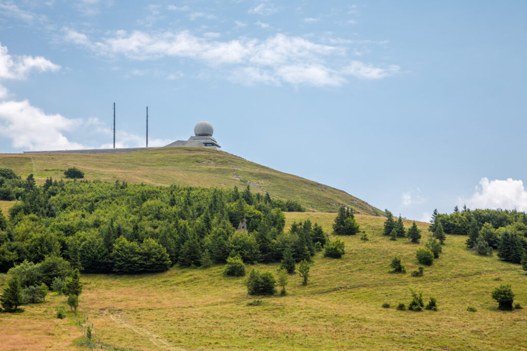
- Distance: 88 km
- Difference in altitude: 2,415 m
- Duration: 3 to 6 days
- Itinerary
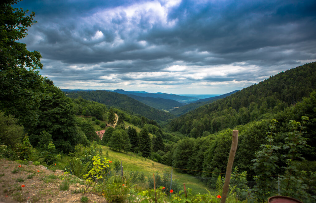
The Route des Crêtes Vosgiennes is another hiking itinerary that takes several days to complete. Set in the heart of the Ballons des Vosges Regional Nature Park, it takes in a number of the massif's most emblematic peaks, including the Grand Ballon, the highest peak in the Vosges. Of course, you can also opt to do just one of the stages of this legendary route, rather than the whole thing. Along the way, remember to practice regenerative tourism to protect this fragile environment, for example by making your hike a clean-up walk.
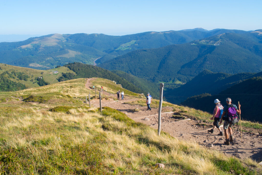
7. The Hohneck summit
- Distance: 11 km
- Difference in altitude: 600 m
- Time : 4 hrs
- Itinerary
This hike in Alsace is divided between the Haut-Rhin and Vosges regions. First you'll climb Petit Hohneck, then Hohneck, the massif's third-highest peak at 1,363m. It's a rather difficult hike, as it's quite steep. However, the looped itinerary will reveal some superb and varied landscapes, some of them on mountainsides. Those prone to vertigo should therefore refrain! And don't forget that you're in the heart of the Ballons des Vosges Regional Nature Park, so it's important to take simple steps to protect the environment. That's why dogs, which can disturb wildlife, are forbidden.
8. Tour of the Grande Ile
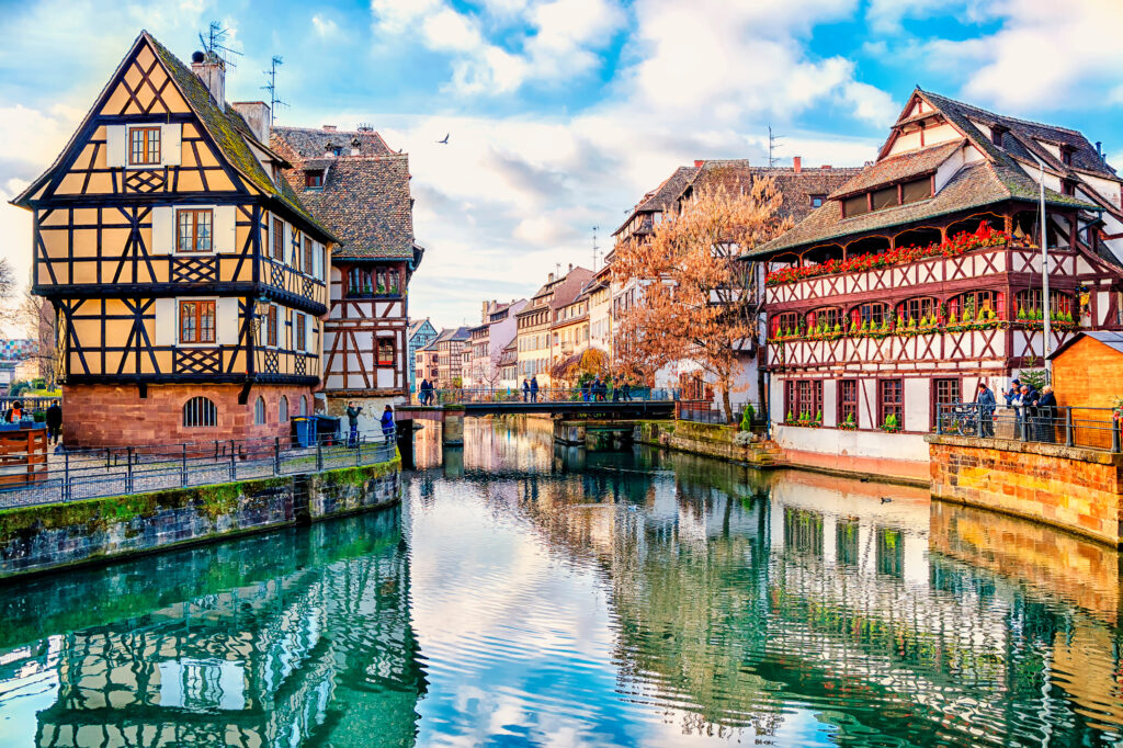
- Distance: 3.7 km
- Height difference: 50 m
- Duration : 1 h
- Itinerary
Leaving the peaks of the Vosges, we head for the city, and more specifically Strasbourg. But this hike in Alsace is no less spectacular, as it takes in the Grande Île, a UNESCO World Heritage site. This historic district is the nerve center of the capital of the Grand Est region, and boasts a truly exceptional heritage. Between the half-timbered houses, you'll also catch a glimpse of Strasbourg's famous and breathtaking cathedral. Walking is the ideal way to discover these treasures!
9. Lac Noir, Lac Blanc and Lac des Truites
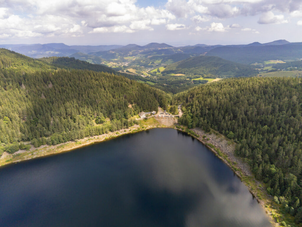
- Distance: 12.2 km
- Difference in altitude: 500 m
- Time : 4 hrs
- Itinerary
Three lakes for the price of one! That's the promise of this magnificent hike in Alsace, which will nevertheless require some effort. It's a medium-level hike, because it's relatively long and has a certain difference in altitude. However, it remains accessible to beginners, who will simply end the day tired. It starts at the Lac Noir Naturefriends' refuge, which you can reach by hitchhiking. Once past Lac Noir, you'll reach Lac Blanc, best admired from the panoramic viewpoint of Château Hans, which isn't actually a castle, but a rock in the shape of one. Finally, the icing on the cake is Lac des Truites, the highest lake in the Vosges.
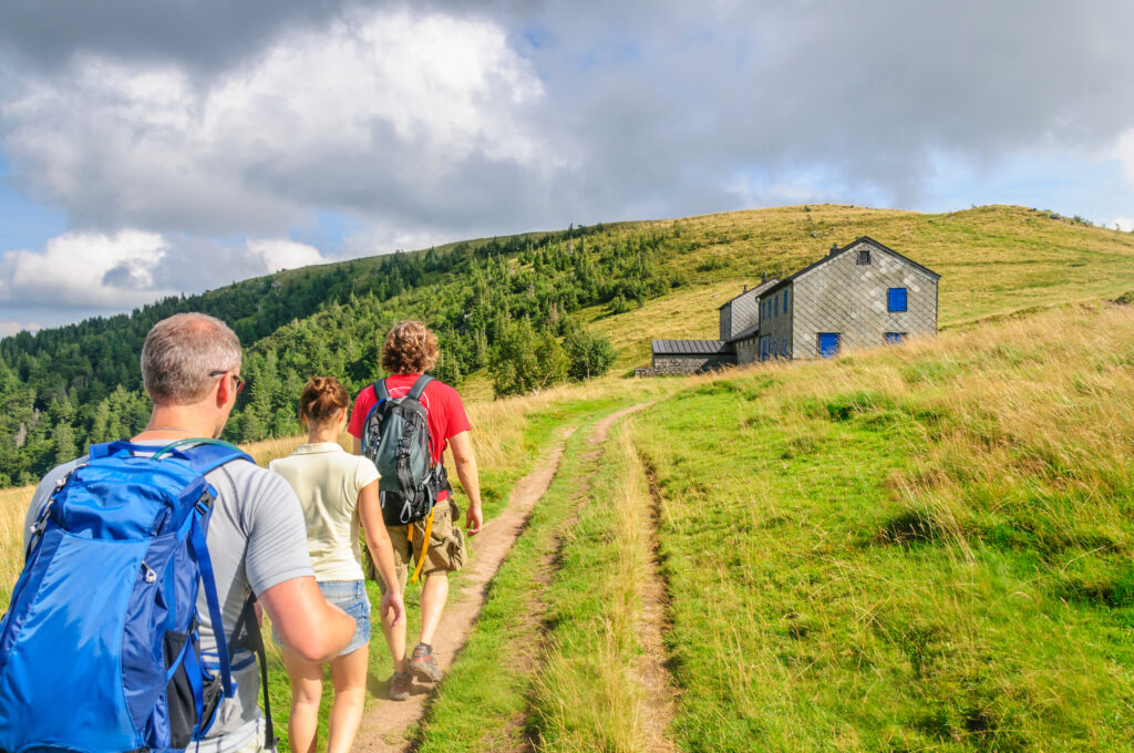
10. The Petit Ballon tour
- Distance: 11.5 km
- Difference in altitude: 420 m
- Time : 3 hrs 30 mins
- Itinerary
This route forms a medium-level loop around the Petit Ballon. In fact, there's nothing small about it, as it rises to 1,272 m above sea level. But the reason it's called Petit Ballon is that it faces the Grand Ballon, the highest peak in the Vosges, and offers an outstanding panorama. Along the way, you'll pass two refuges where you can sleep or eat. Please note that there are no garbage cans on the route, so you'll need to take a small plastic bag with you to ensure that you don't leave any garbage behind, thus reducing your ecological impact.
11. The summit of the Donon
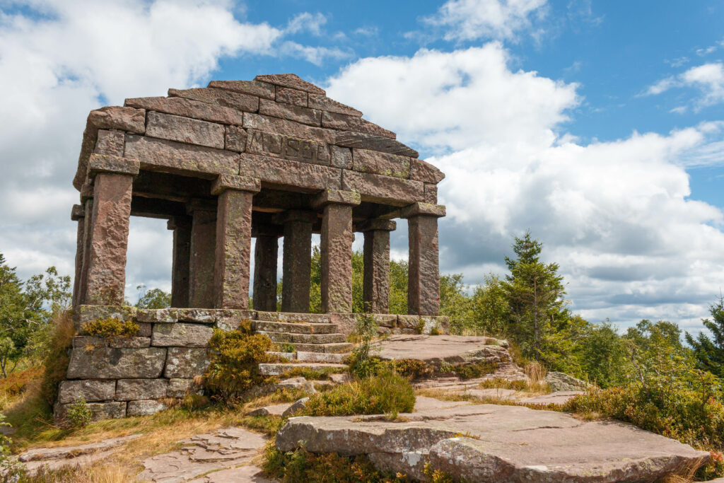
- Distance: 5.5 km
- Height difference: 300 m
- Duration : 1 h 30
- Itinerary
The Donon, a 1,008 m high peak in the Bas-Rhin region of France, is a truly ideal place for hiking. Indeed, this peak offers mid-mountain landscapes that are accessible without too much difficulty, even for families. What's more, it's an interesting place for heritage lovers, as the summit is topped by a temple. Don't be fooled by its Greco-Roman style, it was actually built in 1869.
For other hiking selections, take a look at our articles on the best hikes in the Alps, the best hikes in the Pyrenees and the best hikes in the Auvergne.
Are you tempted? Take a look at our train fares and book now !


